Time Series Land Cover Challenge: a Deep Learning Perspective

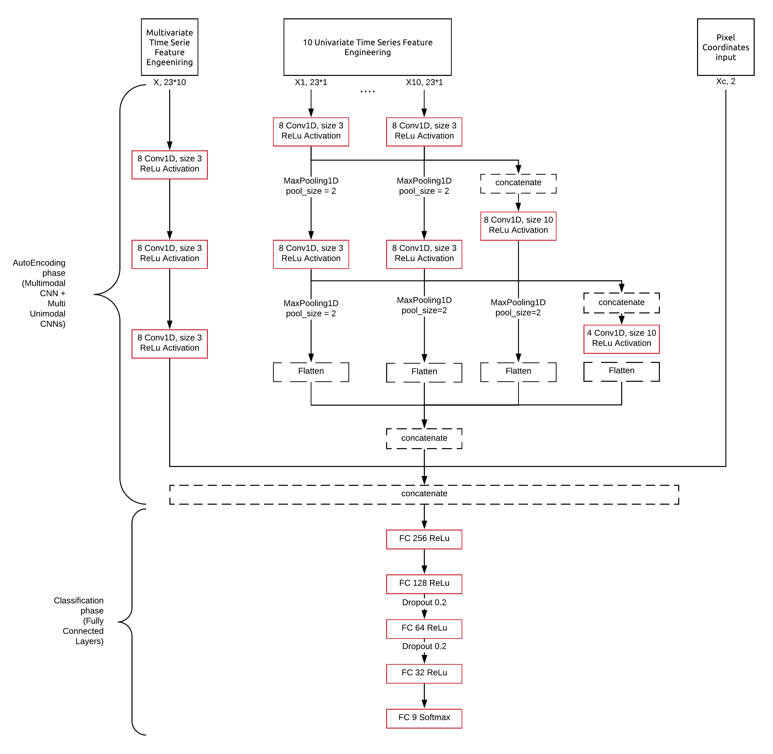
In this project, I explored a Time Series of satellite images dataset by building different deep learning classifiers, finding inspiration in paper research in the field of Time Series classification. Our dataset comprises of 23 images where each pixel is 10 Dimensional.
I firstly took two different perspective when working with the dataset:
- Having 10 unimodal models that I would then concatenate into a single model to retrieve the class of each pixel (I was inspired by the Time-CNN model). I wanted to exploit a presumed independence between the different features of the mutlimodal time series.
- Having one multimodal model that would work on the 10 Time Series of each pixel at once. There, I focused on presumed correlation between Time Series
Finally, I designed a bigger model that would comprises of these two ideas to extract features from both a unimodal point of view and a multimodal point of view.
My final model architecture is the following:
Thomas Di Martino
PhD Student in AI & Remote Sensing
My research interests include deep learning technologies, automatic feature extraction and computer vision, all of them applied to Remote Sensing problematics, more precisely to Synthetic Aperture Radar (SAR) acquisitions.